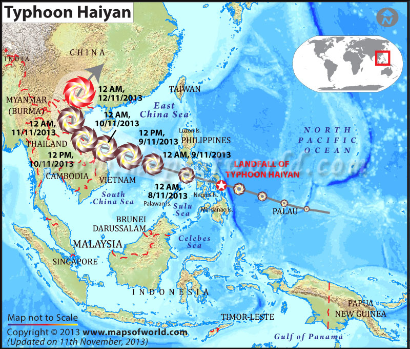
This map was well done tracking the path of the Typhoon that recently plowed through the Philippines. Not only does it show the impact of the typhoon and track the times, but it shows elevation of the surrounding waters, most important being the North Pacific Ocean where it originated. It also has great labeling so that the average person who isn't too familiar with the Eastern World can easily identify what is what.
Source: http://www.mapsofworld.com/world-news/super-typhoon-haiyan/
No comments:
Post a Comment